

Scarborough Land Sale Map c. 1910 framed.
Early c.1910 Scarborough reproduction land sale map, mat laminated 16x20" (50x40cm) mounted and framed.
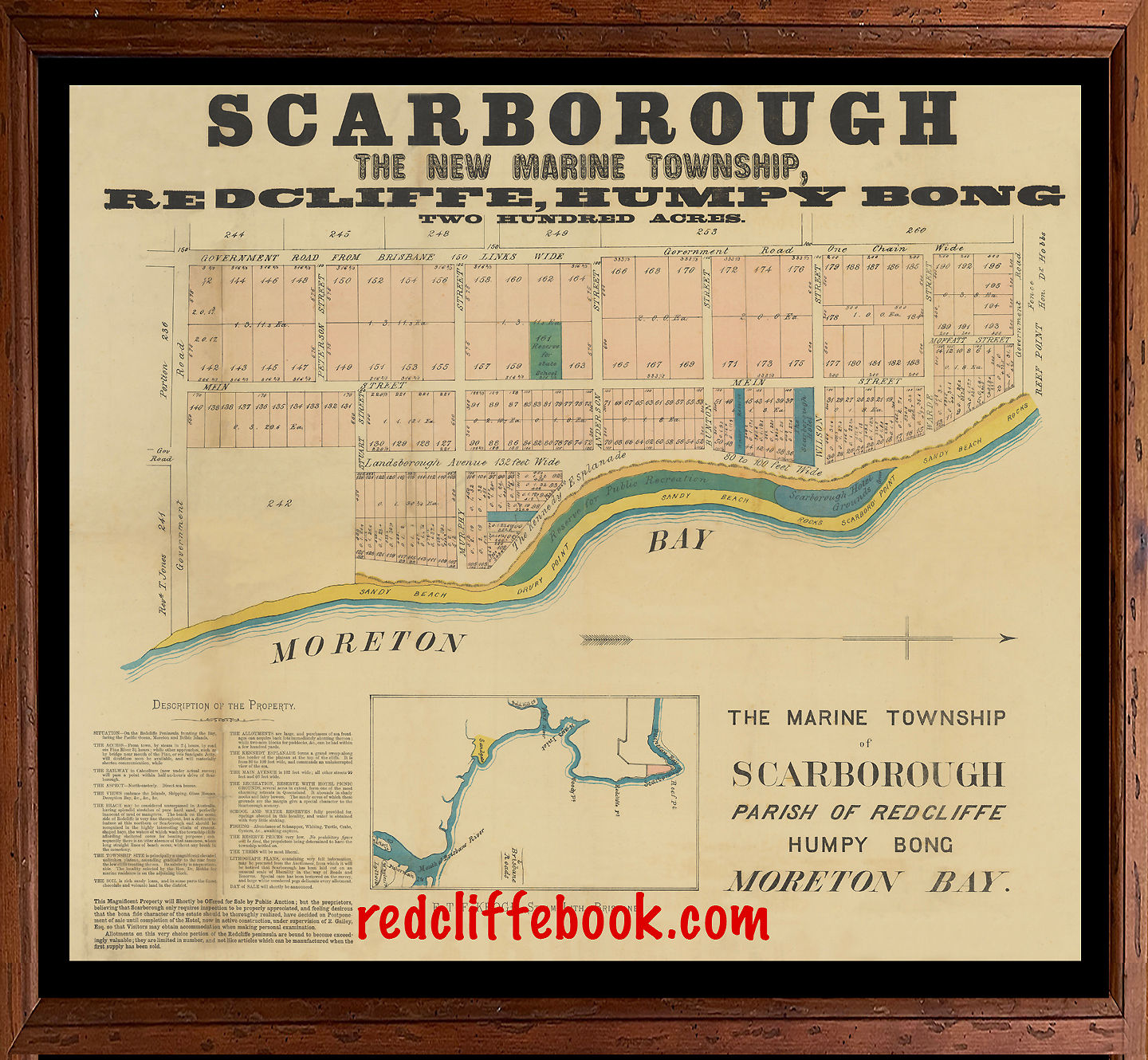
"The new marine township of Scarborough, Parish of Redcliffe, Humpybong, Moreton Bay, two hunded acres"
Featuring land for sale east of "Government Road from Brisbane" (now Scarborough Rd "150 links wide") and north of "Government Road" ( now Griffith Rd) and south of Government Road ( now Fifth Ave)
Early streets named include Mein St, Peterson St, Murphy St, Anderson St, Bunton St, Wilson St (now Rock St) Warde St, Landsborough Ave, ("132 feet wide"), Moffatt St, Stuart St (now Donkin St) and Kennedy Esplanade ("80 to 100 feet wide")
Land owned shown south of Griffith Rd was Rev. T Jones ( block 241) and north of Fifth Ave and Moffatt St, was a fence and Reef Point land owned by Hon. Dr Hobbs.
The "Reserve for state school" is shown "Water reserve" and "The Scarborough Hotel".
Beachfront includes "Sandy Beach, Drury Point, Reserve for public recreation, Scarborough Hotel grounds, Scarboro Point, and rocks"
Various framing options and also available to view and purchase at 5 Alexander St Scarborough. ( 9 to 3 pm Monday to Friday. Saturdays 9 to 1pm) and free delivery in the Moreton Bay region.